Finland’s most famous XR company just turned drone-based 3D capture into a four-click cloud service. Varjo Teleport’s new Autopilot feature lets you draw a polygon on a map, launch an autonomous mission, and come back to a navigable photorealistic neighborhood — up to 100 million Gaussian splats, streamed to any browser. The era of building a drone-mapping pipeline by hand is, mercifully, over.
The Story
Varjo built its name selling $10K+ enterprise XR headsets. But in 2024 it quietly pivoted toward content — the realization being that you cannot sell ultra-fidelity hardware if nobody has ultra-fidelity scenes to put inside it. Teleport 2.0 was that bet: a cloud platform that turns any camera into a Gaussian Splatting capture rig. Now, in May 2026, Varjo has pushed that bet one decisive step further with Autopilot.
The pitch is brutal in its simplicity: “Pick a spot. Teleport flies the drone, reconstructs the capture, and gives you a photoreal 3D neighborhood.” Behind that one sentence lives a stack that most of us have spent the last three years stitching together by hand — flight planning, georeferenced waypoints, image deduplication, COLMAP, training, splat optimization, LOD streaming, web viewer. Autopilot collapses every step into a workflow you could explain to a real-estate agent.

The companion app, Aerial 3D, is free. It generates grid-pattern missions tuned to Gaussian Splatting reconstruction (overlap, angle diversity, altitude) and pushes them directly to compatible drones — no manual waypoint editing in DJI Pilot or Litchi, no spreadsheets, no second-guessing whether your nadir-to-oblique ratio is going to choke training. The drone flies. The cloud reconstructs. You get a link.
The Numbers That Matter
- 10,000 images at 5K resolution per capture — that’s not a demo number, that’s a city block.
- Up to 100 million splats per scene, streamed smoothly to desktop AND mobile browsers.
- 20 billion square meters already captured by beta customers — yes, billion with a B.
- Tens of thousands of missions per month in beta — this is no longer a tech demo.
- Pay-as-you-go pricing for individuals, enterprise tier for fleets, and a Teleport Secure on-prem build for defense and air-gapped clients.

The launch demo is the Vuores district in Tampere, Finland — captured with a consumer-grade DJI Mini 5 Pro. That choice is the loudest part of the announcement. You don’t need an enterprise Matrice with an RTK base station and a calibrated multi-camera oblique rig. A sub-€1,000 drone plus the Autopilot mission planner gets you Hollywood-grade scene capture.
Why You Should Care
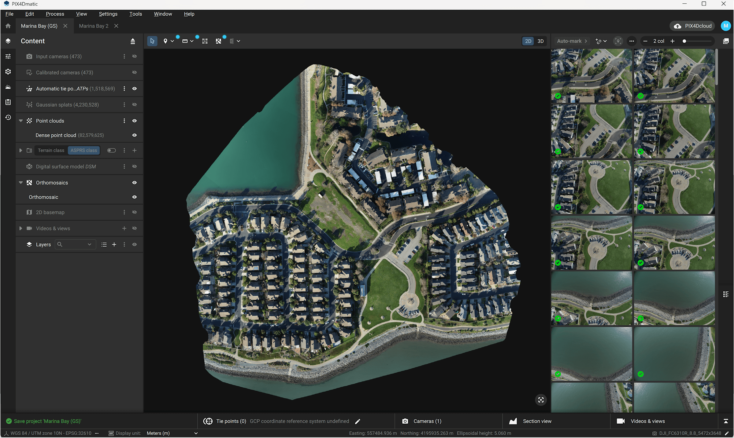
If you’ve been watching the IK3D Lab feed, you already know the splatting industrial complex is locking in. Spatial Fields 1.3 just landed ray-traceable splats on Vision Pro. PIX4Dmatic declared 3DGS production-ready for surveying. Cesium made them streamable as map tiles. The capture side was the last piece of the pipeline still requiring a wizard. Autopilot is the moment that gap closes.
For architects: a site walkthrough that used to mean a half-day terrestrial scan with a Leica BLK now takes one autonomous flight. Construction progress tracking becomes a Tuesday afternoon ritual.
For real estate: neighborhood-scale listings, not single-property listings. You sell the street, not the house.
For game devs and virtual production: location scouts become asset deliveries. Recce in the morning, splat in the afternoon, in-engine by end of day.
For municipalities and digital twin operators: 20 billion m² captured in beta is the strongest signal yet that the digital-twin tooling argument is over. The tech works. At scale. Now.
Try It / Follow Them
- Sign up: get.teleport.varjo.com — free tier, pay-as-you-go for processing.
- Free mission planner: Aerial 3D companion app (grid-pattern generation for compatible drones).
- API access: developer endpoints for embedding captures in your own apps and digital-twin pipelines.
- Air-gapped clients: Teleport Secure on-prem build for defense, energy, critical infrastructure.
- Read the launch: Radiance Fields coverage.
IK3D Lab Take
The unsexy truth about Gaussian Splatting in 2026 is that the bottleneck is no longer the reconstruction. It’s everything around it — flight planning, image curation, LOD streaming, hosting, embed. Varjo just productized that entire moat. Autopilot is not a better algorithm; it’s a better workflow, and workflows are how technologies cross from “cool demo” to “Tuesday tool.”
The thing to watch is whether DJI, Skydio, or Autel pick up the Aerial 3D pattern and bake mission profiles tuned for splatting directly into their stock controllers. The day that happens, every consumer drone becomes a digital-twin instrument. Varjo just gave the industry the blueprint. Six months from now, this stops being a Varjo feature and becomes the default expectation of a drone-to-3D pipeline.
If you’re a creative technologist sitting on a DJI Mini in a drawer, this is your weekend project. Fly a polygon. Share a link. Watch a client’s jaw hit the floor. The barrier to neighborhood-scale 3D capture is now battery life, not technical skill — and that’s the only metric that matters.