Hook
For two years this Lab has chronicled Gaussian Splatting clawing its way out of research papers — into Blender, Unreal, Photoshop, the iPhone, and a hundred startups. On June 8, at the WWDC 2026 keynote, the technique quietly crossed the last and biggest line: it shipped to Apple Maps, and through it to roughly a billion devices. Apple, true to form, never said the words “Gaussian Splatting” out loud. It didn’t have to.
The Story
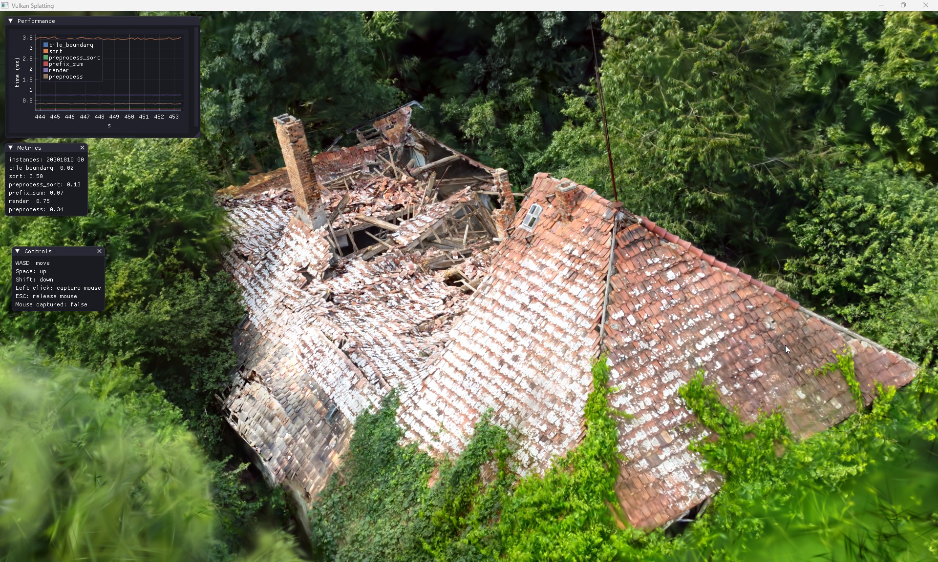
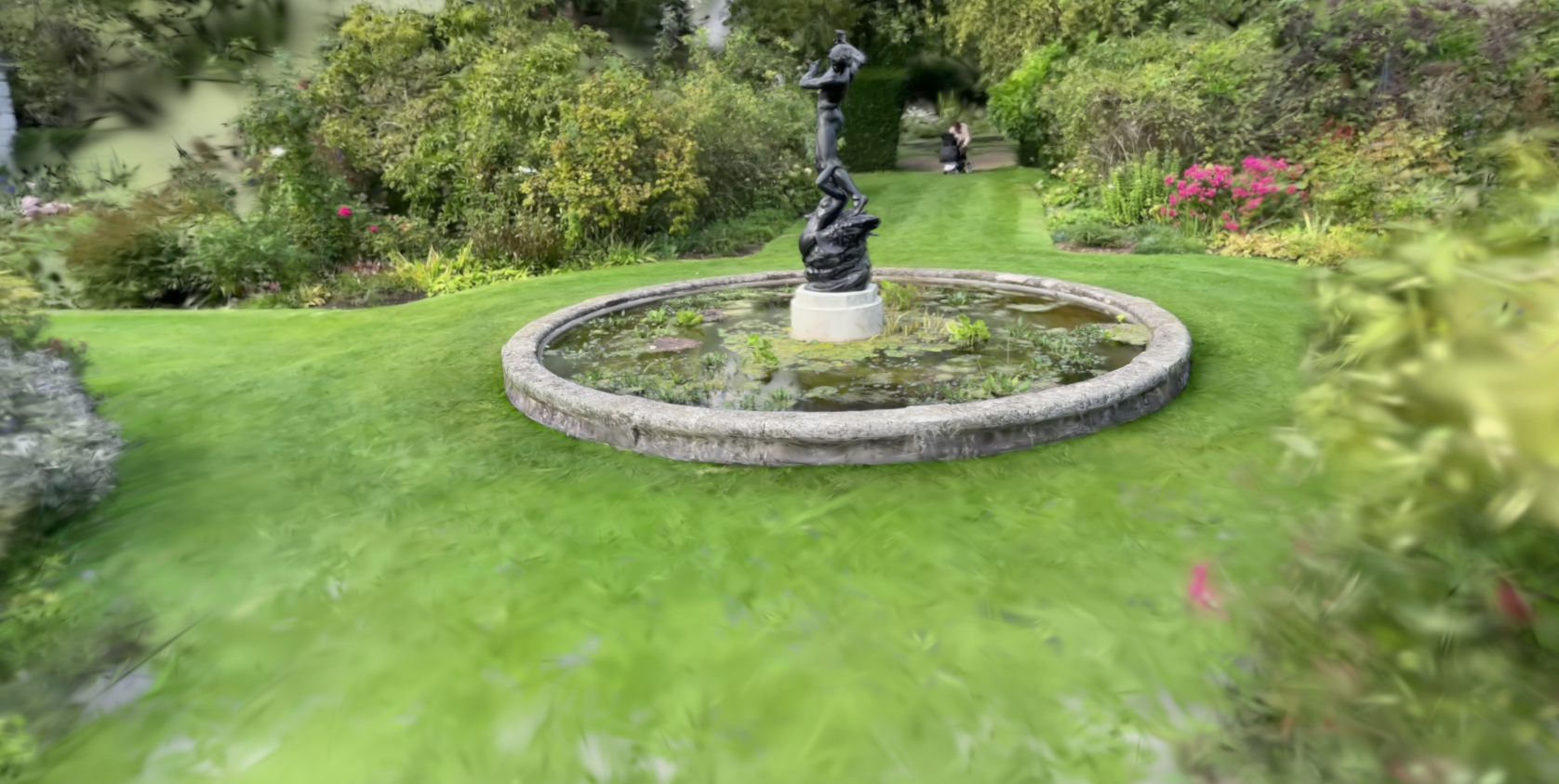
Apple Maps’ Flyover — the 3D city tour mode that has existed since 2012 — has always run on photogrammetry: textured polygon meshes baked from aerial photos. You know the look. Trees that melt into green broccoli. Bridges that sag like overcooked pasta. Power lines that vanish. It was impressive in 2013 and faintly embarrassing by 2026.
At WWDC 2026, Apple announced Flyover is being rebuilt on 3D Gaussian Splatting. The company described it only as a new system that delivers “sharper detail, from the shapes of individual trees to the way light reflects off the glass of skyscrapers” — but that description, plus the view-dependent specular highlights on display, is a radiance field signature. The pipeline has two halves: fresh aerial footage captured from planes, and Apple’s Visual Intelligence models trained to turn those frames into coherent 3D scenes. In other words: photos in, millions of semi-transparent, view-dependent Gaussians out. The same representation Bernhard Kerbl’s team published in 2023, now industrialized at planetary scale.
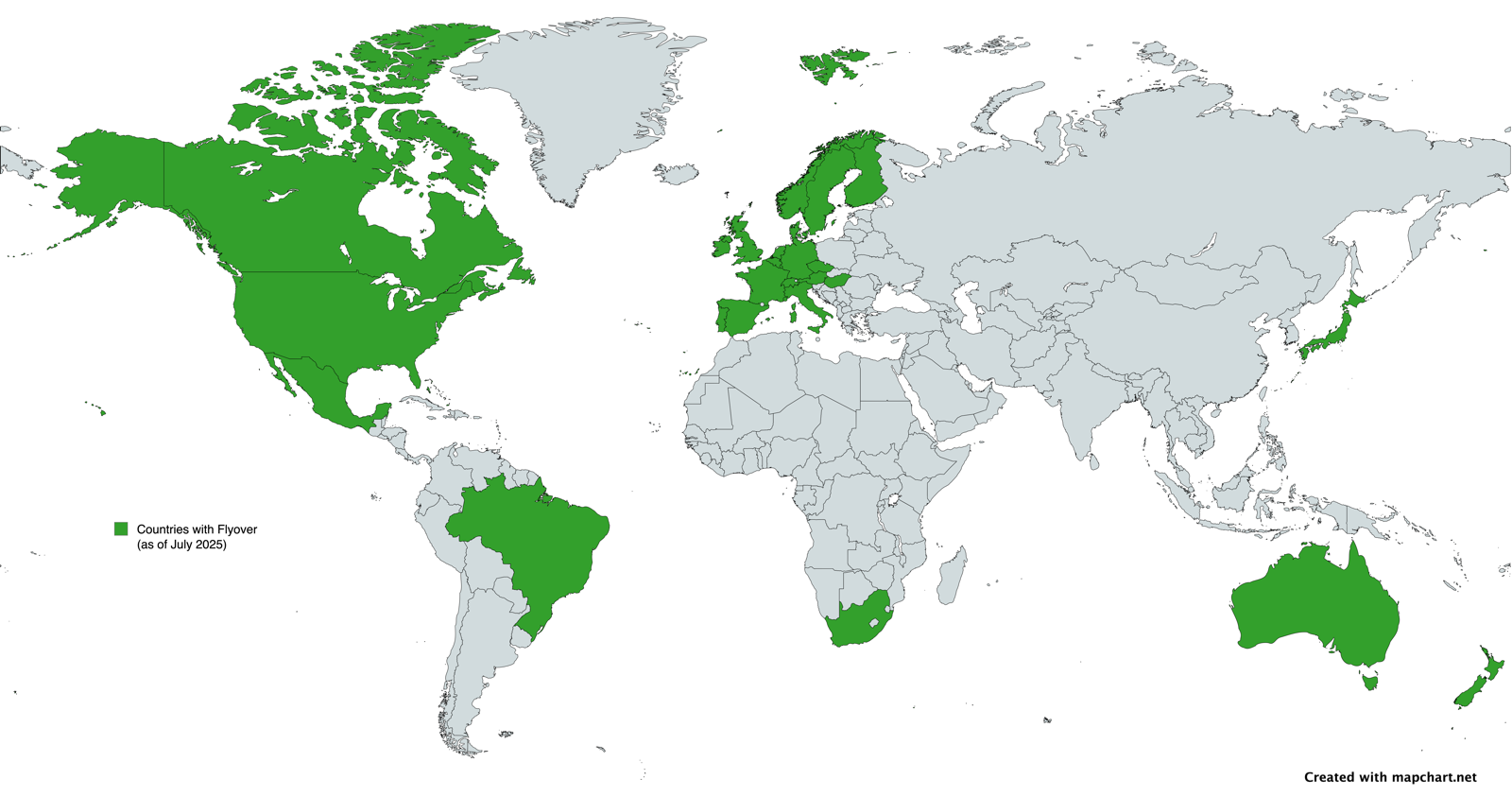
The scale is the headline. Flyover’s catalog already spans 300+ cities and landmarks, and Apple says all of them are slated to migrate, rolling out city-by-city. It ships in fall 2026 with iOS 27, macOS 27 and visionOS 27 — the same window as the iPhone 18 Pro. That makes it, by a wide margin, the largest 3DGS deployment ever attempted.
Apple isn’t first to radiance fields in maps — Google has run NeRF-based Immersive View (Mip-NeRF 360, Block-NeRF) in a handful of cities like London, New York and Tokyo for a while. The difference is integration and ambition: Google built a separate “immersive” mode for a few cities; Apple is replacing the standard Flyover everywhere it exists, and betting on splats — which rasterize faster and cheaper than NeRF’s volumetric ray-marching — to make it run smoothly on a phone.
Why You Should Care
If you make 3D things, this is the validation event. Not a VFX studio, not a 50-person Discord — Apple, the most conservative platform vendor on earth, just bet its flagship maps product on the technique you’ve been experimenting with. A few things follow:
- Splats are now a consumer-default visual language. Once a billion people pinch-zoom photoreal splat cities, “blobby photogrammetry” becomes the thing that looks dated. Your clients’ expectations just moved.
- RealityKit got native 3DGS too. The quieter, more actionable WWDC news: visionOS 27’s RealityKit now renders Gaussian Splats directly, alongside physical-space lighting, projective textures and cloth sim. You can drop a photo-scanned object onto a real table with correct lighting — no hand-modeling. That’s a creator API, not just a maps feature.
- Aerial-to-splat is a real, repeatable pipeline. Apple just proved the “drone/plane footage → AI → navigable splat” workflow works at city scale. The same loop (see the featured image above) is within reach for anyone with a drone and Postshot, KIRI, or Nerfstudio.
Try It / Follow Them
- Build the aerial-to-splat loop yourself: capture with a drone, train in Postshot, KIRI Engine, or open-source Nerfstudio / gsplat, then view in the browser.
- Ship splats into Apple’s ecosystem: grab the visionOS 27 / RealityKit 3DGS docs from Apple’s developer site once the SDK seeds drop, and read Apple’s own HUGS (Human Gaussian Splats) research for where their heads are at.
- Track the field: Radiance Fields has the running coverage, and @RadianceFields on X breaks news first.
IK3D Lab Take
There’s a special satisfaction in watching a research technique become invisible infrastructure. The papers we covered, the open-source viewers, the indie capture apps, the Blender and Photoshop plugins — that whole grassroots build-out is what made it safe for Apple to bet a tentpole feature on splats. The fact that Apple won’t even name the technique is the tell: Gaussian Splatting has stopped being a “craze” and become plumbing. The interesting frontier now isn’t can we splat a city — Apple just answered that for 300 of them — it’s what you build on top once photoreal 3D reconstruction is a free, ambient capability sitting in everyone’s pocket. That’s the part still wide open. Go claim it.


